Saturday, May 29, 2010

On to Valdez

Well, today is Saturday and it's been 5 months and one day since this odyssey started. The wildfire is still burning west of Tok, after it started 5:00 pm Wednesday. The cause was apparently dry lightning. The area covered by it is over 2,000 acres. The water bombers have pretty well worked non stop, as well as the ground crews. It jumped the highway again yesterday. There are 67 wildfires in the state now affecting 74,000 acres. The top pic is smoke that drifted 10 miles from the fire, to the campground yesterday morning ( Friday). We are now on the way to Valdez, the site of the oil spill from the wrecked ocean tanker Exxon Valdez back in the 80's. We may go fishing on a charter there if there are fishing running. The second photo is on Mt. Sanford at 14,000+ feet. The last is of more boring mountainous landscape.

Posted by Picasa

Thursday, May 27, 2010

Smallish fire


We have internet again ...sorta. Things really are different in the North. The things you take as being "normal" down South are often a luxury here....internet being one of them. The trip to Tok, one current location was MUCH smoother, road wise, once we cross into Alaska. The rebuilt a large portion of the highway from the border to Tok in the last 2 years. Our stay here will be for 3 nights which started last night, Wednesday. There is a forest fire going on at the moment, about 10-12 mile west of here. The evacuated a village last night as a safety precaution. It covers about 2,000 acres and jumped the highway to burn another 20 . It is still burning at 2:00 Alaska time, which is 4:00 Shelburne time, but under control. We took a drive over there and that is what the pics are of. I will try to copy and paste an email which was sent to some for pre..vious updates.
Posted by Picasa

Friday, May 21, 2010

Back again

We were without Internet service for a couple of days while in Skagway Alaska. We actually were in two different Provinces or Territories (BC & Yukon) and two countries (USA + Canada) in the space of 50 miles. On the way to Skagway, we had actually planned to camp at Carcross, but they really weren't open for business yet, so we carried on to Skagway. On the way we had to climb ( with the truck) White Pass. No problem for the Dodge handling the 11.5 mile climb with a 11% grade....WOW. The elevation at the top.....3292 ft...Skagway.....0 ft ( sea level). The population of Skagway, during non tourist season is 865, but they will get 893,000 visitors, mainly from the cruise ships, during the season, which this year started May 5th. We did a walking tour of the downtown area on the 20th noting the large number of crafts made of silver, gold . Most of these are done by the Tlingit people that are native to the area. In the evening we attended a free ( for the residents of the town) live theatre show called The Soapy Smith '98 Review. This is production highlighting the life of a real con-artist of the area. Great show. Prior to that evening show, we visited Dyea a ghost town that in 1898 had 10,000 people living there...5 years later it was deserted. The Chilkoot trail also started at Dyer. This is the trail is the one that shows an endless line of men going up a trail loaded with cargo on their backs, in heavy snow. Each person was required to take 2000 lbs of provisions up this trail. It took up to 30 trips to do this. We walked about 200 yds, in the summer, and called it quites. After leaving Skagway on the 21st, we headed towards Whitehorse. On the way we stopped at Emerald or Rainbow Lake for lunch. This is a lake that has many bright colours caused by the minerals in the lake. We also saw the smallest desert in the world. Quite a contrast with the mountains in the background. Yesterday, Saturday, saw us take a tour around Whitehorse, after meeting the sons of friends from Shelburne, for breakfast. One of them is an RCMP officer which seemed strange to be sitting beside in an eating place. We saw the Klondike, a stern wheeled river boat that is now a museum. Also visited was a log church which again is a musum showing the hard life these early preachers had. The Transportation Museum was also of interest as it showed the various modes of transport in the early north ( including a '29 AA Ford). There is also a full size airplane out front which is the world's largest weather vane. An unusal site was the 3 story log structure which is now an apartment building from the look of it. We will leave Whitehorse tomorrow and I will try to post pictures to the album today. We are on dial-up here so things are S L O W .

Tuesday, May 18, 2010

YUKON

After leaving Iskut BC, we continued on the Cassiar Hwy (#37) towards the Yukon border. The road became more and more rough as we travelled, mainly in the areas that had been gravel and now have a single layer of tar/asphalt. The night was spent at Nugget City which for the most part was closed. As it turns out, we are early for the tourist season in spite of what the tourism books say. We ended up staying there,but with out water and electric coming from the store located there. There was no sewer hookup which isn't a problem, as our two holding tanks ( black and grey water) each hold about 40 gallons. We stopped at a Jade store on the way. About 90% of the world's JAde comes from BC but the carving of it is shipped off shore because of the labour costs.We had enterd Yukon at about 3:30 yesterday (Monday) Today the mountains were left behind for a while as we entered the Yukon Plateu, however the Cassiar Range soon reappeared. There was a waterfall to visit on the way to Teslin which after a 1/3 mile walk, turned out not to be too spectacular, but nice to see anyway. On picture #3, we took the top option and headed towards Whitehorse. Tonight we are in Teslin YK. Each little place with a name is pretty well self-contained with an eating place, fuel, motel and camping, although as mentioned before, we are too early for some of the services.
Posted by Picasa

Sunday, May 16, 2010

Gettin' there

It was an easy drive today up the Stewart-Cassiar Hwy (Hwy 37) from Meziadin Lake to Isakut where we are spending tonight. The only wildlife spotted were 3 black and 1 grizzly bear. It was a great drive through the Coastal Mountains. The bush has changeded from mainly pine and cedar to Aspen and lodge pole pine and balsam and spruce. As the pictures show, the campground ain't too bad !!!!
Posted by Picasa

Saturday, May 15, 2010

No Border Patrol !!!


A side trip was taken today, from our second day at the Meziadin Lake Prov Park, to Hyden AK, where there was NO American customs Office. This hamlet is direct across from Stewart BC with it's population of 350 ( and a Canada Customs office). The population of 71 in Hyden and no where to go once you where there likely explains that. Hyden is the most Southerly point in Alaska accessible by road. The intent was to drive to the Salmon Glacier about 20 miles from Hyden, but a combination of very rough gravel roads and snow blocked roads two miles from the glacier made the decision to turn around after about 3 miles. Where we turned, offered an elevated walk-way to view the bears feeding on Salmon, however they must have been full as there where no bears or Salmon to be seen. The top pic is of the Bear Glacier which feeds into Bear Lake which in turn produces Bear River. The bottom picture is of the remains of an avalanche. This particular area is prone to avalanches all year round.
Posted by Picasa

Friday, May 14, 2010

Surprise !!!!


There is but one Provincial Park in all of BC that has internet service AND WE FOUND IT. There aren't any services, so the newly purchased generator is getting it's first test. The drive to Meziadian Lake Prov Park from Smithers was beauitful. We are now heading north on the Cassiar Hwy # 37. We are going to Alaska tomorrow to a place called Hyder AK which is about 2 miles from Stewart BC. The top picture here was taken a 10:00 last night from the campground in Smithers. The bottom is our campsite tonight (Friday). Wild life report!!!!! 1 bear, 1 fox, 1 bald eagle. There is a mother black bear and two cubs that come into this park, so Brandy is confined to a lead.
Posted by Picasa

Thursday, May 13, 2010

Smithers

Today may be the last posting for a while, as we are getting into territory that is lacking in telecommunication signals.
We went to see a Provincial Park today called Driftwood, which has a large fossil exibit made up mainy of ferns flowers etc. This was once a sea bed....hard to believe today. However, we could only get as far as the walking path to a cliff face where some loose shale was located. The reason for the lack of progress was the road blocked with snow drifts !!!!!! This didn't deter us from going to our next stop, the Twin Falls. Here we WALKED 1/2 mile to the falls, again snow was on the ground,,,but not too much, Brandy loved it. The view was nice. Although the falls lacked volume, they certainly had height....about 500 ft. These two falls are fed by glacial runoff. I neglected to mention our wild life viewing of yeterday, one moose, three deer and two bear. Today...nothing !!!
Posted by Picasa

Wednesday, May 12, 2010


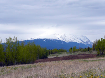
Well the Interior Plateau is now behind us as we head back into the mountains. The drive today took us from Vanderhoof, which is the geographical center of BC, to Telkwa about 7 miles from Smithers. It appears we are far enough North now, that we have to check ahead to ensure campgrounds, Provincial Parks and various attractions are open, before striking off. Some do not open until the end of May. The first picture is of Eagle Peak. The second is Hudson Bay Mountain at Smithers. We hope to get to it tomorrow ( Thursday) and check out the Glaciers and also to a Provincial Park to see some fossils
Posted by Picasa

Monday, May 10, 2010

9-3

Our last day at Quesnel had us take a drive to a once booming gold town called Bakerville. The drive there was not dull. First, we climbed from 2200ft. to 4500' at Bakerville. Then we saw a total of 8 bears consisting of 2 mothers with two cubs each (black bears). These were about 5 miles apart. Next came a Grizzly all alone, then one more black. In between there were three seperate sightings of deer. Stay with me, I know that's 8 bear and 3 deer. The town itself was great. It is the single largest attended historic site in BC. Most of the building are restored originals and the balance are built to photographs or original sketches. Because of the altitude snow was still around, but not nearly as much as this time last year when one of the cabins was coverd in 8' of snow on May 10th. The Chineese had there own section of town that while close to the mining town was a little further up hill. This fact spared the China Town from fire in the mid 1860's. It was a full day which was really enjoyable. Oh ya, bear number 9 was spotted on the way back to Quesnel. Please see the web album for 25 more pictures.
http://picasaweb.google.com/192950A
Posted by Picasa

Sunday, May 9, 2010

Mother's Day

Finds us still enjoying Quesnel BC. It really is a pretty area. One thing that has been noted is the increasing lenghth of the days as we get further North. The sun is up well before 6:00 pm and at 10:00 pm the sky is still not dark. We've been driving around looking at the town and surrounding area. we've"done" an antique mall, garage sales and farmer's market. Checked out what it takes to buy waterfront property ($300,00.00 and up) and stayed "home" and read. Monday will take us to Barkerville, which at one time was the largest place North of San Franciso and West of Chicago. It was also felt that Vancouver and Victoria would never do well because they were too far from Barkerville....it is now a restored ghost town.

Tuesday, May 4, 2010

Plans change

We had intended to stay at Williams Lake tonight, however, the campground we went to, was under,construction. As a result, up the road we went to Quesnel and a beautiful place on the lake with large open sites. We booked in for a week, as we wish to go to Barkerville and see the old gold town. It doesn't open, or at least the attractions don't, until the 1oth. It'll give us a chance to recharge a bit. The weather has been cool, but considering where we are, it isn't too bad.

Monday, May 3, 2010

No insects


We once again have Internet service!!!!!! Just to catch up, April 26 saw us in Merritt BC. The 27th took us into town (which is the country music capital of Canada ...yeee haw). There are murals on many of the buildings of music satrs, both modern and classic country. They also have many "stars "on various buildings with hand prints inbedded in concrete and hung there. There is an overlook of the town from about 1000' which we enjoyed. We also purchased a 3500 watt generator. It was a good price, new, and we felt it would allow us a bit more in campground selection where there isn't electricity. May 28th was our drive to Sorrento on Shushrop Lake and the beginning of a four night stay with friends of ours, the Cowan's, at their new home which they have been building for the past 2 years. For pics of the house and other pictures go to the album page at http://picasaweb.google.com/192950A. On the way to Sorrento, we walked into a water fall at Chase BC, which we all ( Sue, Bill and Brandy) enjoyed. The 29th was dedicated to doing zero...a full day of loafing. We took a trip into Salmon Arm on the 30th and drove around the town, took ANOTHER walk to Margret Falls and on the way home toured some modular homes....curious, just curious. Bill & Sue Cowan still own their log house at Louis Creek and Bill C and myself drove over there on May 1st to use his saw mill to cut some timbers for the new house. On the way, I just had to take a picture of the '31 AA sitting at the side of the road....not to bad a condition either. We said our good'byes on the 2nd ( yesterday) and continued on to spend the night at Little Fort BC. A nice little campground/motel/restaurant combo. Tonight camp is at Lac la Hache which is north of 100 mile House on Hwy 97. We aren't going to dwell on the fact we had snow at 4300 feet today. This was after a 14 km 8% upgrade hill. The good (?) news is there aren't any insects !!!!
Picture #1 is of Margrets Falls, #2 is the AA and #3 is of Adam's Lake near Sorrento
Posted by Picasa